Aurora Forecast and Prediction for Colorado Springs, Colorado
Did you mean: Colorado Springs Airport, Colorado, United States?
Kp: 0 | Bz: -0.7
Best Viewing Window: 6:38 PM – 6:53 AM MDT (12h 15m) · peak hours typically 10:58 PM – 2:58 AM
 Best Viewing Window:
6:38 PM – 6:53 AM MDT
 Full Moon 100%
Space Weather Now
Timing: Tonight
Webcam
No aurora cams nearby. Center on nearest camera (848 mi away).
Browse other webcams on Windy3-Day Forecast for Colorado Springs, Colorado
Oct 25
Kp 3 is short of the roughly Kp 9 the aurora needs to clear the northern horizon from Colorado Springs.
Global: Moderate planetary activity expected - aurora across the high-latitude zone, and lower with a good substorm.
Best time to look up: 6:00 PM–9:00 PM MDT
30% chance of elevated activity · Kp 3 during viewing window
Oct 26
Kp 1.7 is short of the roughly Kp 9 the aurora needs to clear the northern horizon from Colorado Springs.
Global: Quiet planetary conditions expected - aurora mostly confined to the far north.
Best time to look up: 12:00 AM–3:00 AM MDT
10% chance of elevated activity · Kp 1.67 during viewing window
Oct 27
Global: This night's forecast isn't in NOAA's 3-day window yet - check back closer to the date.
This night's forecast isn't available yet - check back closer to the date.
Aurora Oval & Satellite & Sun
Interactive Aurora Globe
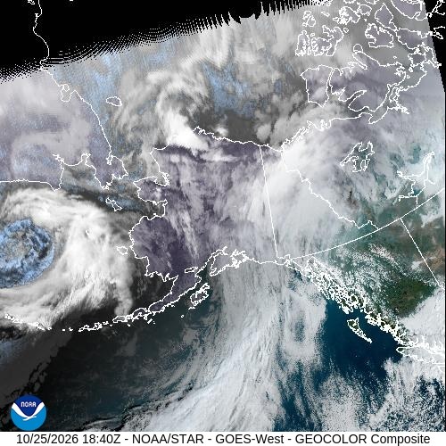


Satellite View

Sunspots
Current sunspot number: 22

Coronal Mass Ejections
Aurora Photography by Todd Salat
Original prints from Todd Salat's collection.

Treasure Trove
Seward, AK · 2023

Tree of Life
Arctic Circle, Alaska · 2025

Valley of Light
Brooks Range, Alaska · 1999
Nerd Mode
Solar Wind & IMF (GSM)
- Bt
- 2.5 nT
- Bx
- -1 nT
- By
- 2.1 nT
- Bz
- -0.7 nT
- Clock Angle θ
- -16.9°
- Cone Angle φ
- 114.8°
- Speed
- 349 km/s
- Density
- 2.9 p/cc
IMF Detail (GSE) & Source
- Bx
- -1 nT
- By
- 2.3 nT
- Bz
- -0.1 nT
- θ Angle
- -1.7°
- φ Angle
- 113.7°
- Satellite
- SOLAR-1
- Data Quality
- Good
- Reading Time
- Oct 25, 12:00 PM MDT
Geomagnetic Indices
- Kp (now)
- 0
- Dst
- -5 nT
- HPI
- 8 GW
- Sunspot Number
- 22
Aurora Model
- Ovation Value
- 0
- Ovation Label
- None
- Model Data Time
- Oct 25, 1:06 PM MDT
- Ovation Data
- Live
Scores & Ratings
- Aurora Visibility
- 0 · Poor
- Aurora Visibility (w/ Moon)
- 0 · Poor
- Prediction Score
- 0 · Little to None
Sky & Location
- Cloud Cover
- 100% · Overcast
- Clouds, Next Dark Window
- 95% · Overcast · ×0.05
- Aurora Visibility Tonight
- 0 · Poor (Outlook Tonight 0 × cloud 0.05)
- Solar Elevation
- 38.1° · Daytime
- Moon Phase
- Full Moon
- Moon Illumination
- 100%
- Moon Altitude
- -36.9° · Below Horizon
- Latitude
- 38.83388
- Longitude
- -104.82136
- Geomagnetic Latitude
- 46.5°
- Horizon Threshold
- Kp 9
- Overhead Threshold
- Never
Prediction Model Inputs
- Bz Persistence (60min)
- -0.8 nT
- Newell Coupling
- 2591
- Latitude Gate
- 0.00 now · 0.00 tonight (horizon Kp 8.8, verdict rounds to Kp 9)
- Dynamic Pressure
- 0.6 nPa
- Storm Watch (CME)
- —
- Watch Predicted Kp
- —
Timing & Signal Agreement
- Timing
- Tonight
- Signal Agreement
- High (5 of 5)
- Do the live inputs point the same way as the score? A score lifted by this city's own Kp can read Low while the solar wind is calm.
- L1 Delay
- ~72 min
- Magnetic Midnight
- 12:58 AM (peak hours 10:58 PM – 2:58 AM)
- Best Viewing Window
- 6:38 PM – 6:53 AM MDT (12h 15m)
3-Day Kp Forecast
| UT slot (MDT) | Oct 25 UT | Oct 26 UT | Oct 27 UT |
|---|---|---|---|
| 00–03 UT (6:00 PM–9:00 PM) | 2 | 3 | 1.67 |
| 03–06 UT (9:00 PM–12:00 AM) | 3 | 2 | 1.33 |
| 06–09 UT (12:00 AM–3:00 AM) | 3 | 2 | 1.33 |
| 09–12 UT (3:00 AM–6:00 AM) | 3.33 | 2 | 1.33 |
| 12–15 UT (6:00 AM–9:00 AM) | 4 | 2 | 1.33 |
| 15–18 UT (9:00 AM–12:00 PM) | 3.33 | 2 | 1.33 |
| 18–21 UT (12:00 PM–3:00 PM) | 4 | 2 | 1.67 |
| 21–00 UT (3:00 PM–6:00 PM) | 3 | 2.33 | 1.67 |
| Max | 4 | 3 | 1.67 |
| Ap Index | 18 | 8 | 5 |
Columns are NOAA's UT days, so in MDT a column's first rows fall on the previous local evening.
Storm Probability
| Level | Oct 25 UT | Oct 26 UT | Oct 27 UT |
|---|---|---|---|
| Active | 35% | 30% | 10% |
| Minor storm | 25% | 5% | 1% |
| Moderate storm | 10% | 1% | 1% |
| Strong-Extreme storm | 1% | 1% | 1% |
Planetary K-index
Interplanetary Magnetic Field Bz-0.9 nT now
Southward (negative) Bz favors aurora. Observed data only, no forecast product exists for Bz.
Total IMF Field Bt2.7 nT now
Total interplanetary magnetic field strength - the ceiling on how negative Bz can go. A rising Bt alongside a still-fluctuating Bz often leads a stronger southward turn. Observed data only, no forecast product exists for Bt.
Global Storm Trend14 global now
Global (hemisphere-wide, not this city) prediction score over the last 24 hours, logged every 5 minutes - may differ from the Prediction ring above, which is specific to this location and time of night. Red from 60 (Strong), yellow from 40 (Moderate), teal below - the same cutoffs as the Prediction ring. Dashed line is the overall trend.
Dst History-5 nT now
Kyoto Dst geomagnetic storm index over the last 24 hours. Negative = ring-current energy stored = an active storm, not just predicted. Red below −50nT, yellow −20 to −50nT, teal above −20nT.
Solar Wind Speed & Pressure
Each line is scaled independently to its own 24h range (different units) - watch the shape, not a shared axis. A rising speed line or a pressure spike can signal an incoming stream or shock before Bz/Dst move.
Nerd Mode: See what’s really driving the score. Live solar wind, Bz, Kp, Dst, CME timing, and more. Data comes from NOAA SWPC and the Kyoto WDC, with a few metrics calculated here from the raw data. Live data refreshes every minute; trend charts every five.
Aurora Forecasts for Nearby Cities
Checking conditions somewhere else tonight? These are the closest cities with their own northern lights prediction.
- Colorado 41 mi
- Aurora 62 mi
- Denver 63 mi
- Boulder 85 mi
- Fort Collins 122 mi
- Cheyenne 159 mi
- Albuquerque 278 mi
- Casper 289 mi
Debug / Test Data
UTC: 2026-10-25 18:03:48
| Variable | Value |
|---|---|
| Geo | |
| locale (GET) | colorado-springs |
| pred_city | Colorado Springs |
| pred_region | Colorado |
| pred_lat | 38.83388 38.83388° N |
| pred_lon | -104.82136 104.82136° W |
| pred_tz | America/Denver |
| Cloud Cover (Open-Meteo) | |
| cloud_pct | 100% |
| cloud_cover | overcast |
| cloud_mult | 0.05 (5%) |
| Sky Darkness | |
| dark_elev | 38.06° |
| dark_label | Daytime |
| dark_mult | 0.00 (0%) |
| Space Weather | |
| cKp (current) | 0 |
| bz (nT) | -0.7 |
| speed (km/s) | 349 |
| day1_max Kp | 4 |
| day2_max Kp | 3 |
| day3_max Kp | 1.67 |
| Aurora Score 0–4 None · 5–19 Weak · 20–49 Nearby · 50–100 Overhead | |
| ovation_val | 0 (None) |
| ovation_time | 2026-10-25T19:06:00Z |
| space_score | 0 |
| Space Weather | |
| bz_score | 7% |
| bz_bar | 53.5% (visual) |
| kp_score | 0% |
| fcst_score | 57.1% |
| Visibility Score 0.15×Ovation + 0.55×Bz + 0.30×Kp | |
| activity_score | 0 |
| Aurora Visibility Visibility Score × cloud × darkness | |
| × cloud_mult | 0.05 (Overcast) |
| × dark_mult | 0.00 (Daytime) |
| aurora_score | 0 (Poor) |
| Aurora Visibility Tonight Outlook Tonight × cloud (dark window) × 1.0 | |
| pred_score_tonight | 0 (Little to None) |
| × cloud_mult_tonight | 0.05 (Overcast 95%) |
| aurora_score_tonight | 0 (Poor) |
| Cache Freshness * = per-request, no cron | |
| Kp Index _kps/ | fresh 46s / 60s |
| Bz / RTSW outlook/ | fresh 4s / 60s |
| Solar Wind outlook/ | fresh 2s / 60s |
| Sunspots _kps/ | fresh 15.3h / 24h |
| Ovation Aurora outlook/ | fresh 3m / 5m |
| 3-Day Geomag * outlook/ | fresh 3m / 1h |
| GeoIP DB geoip/ | fresh 10.5h / 168h |
| geo (newest) * outlook/geo/ | fresh 91s / 24h |
| wx (newest) * outlook/wx/ | fresh 1s / 20m |
| Image Cache /_files/_dynamic/_images/ · cron every 15m | |
| Ovation North | fresh 4m / 15m |
| Ovation South | fresh 4m / 15m |
| Sat - Alaska | fresh 4m / 15m |
| Sat - N. America | fresh 4m / 15m |
| Sat - N. Atlantic | fresh 4m / 15m |
| Sat - Europe | fresh 4m / 15m |
| Sat - Australia | fresh 4m / 15m |
| Sat - S. America | fresh 4m / 15m |
Legend
| Visibility Rating (aurora_score /100) | ||
|---|---|---|
| Poor | 0–29 | Little chance of seeing aurora |
| Fair | 30–49 | Possible under ideal conditions |
| Good | 50–69 | Good chance if skies clear |
| Excellent | 70–100 | Strong aurora likely visible |
| Ovation Label (0–100 scale) | ||
|---|---|---|
| None | 0–4 | No aurora activity at location |
| Weak | 5–19 | Faint aurora, auroral oval nearby |
| Nearby | 20–49 | Aurora active, oval edge overhead |
| Overhead | 50–100 | Aurora directly overhead |
| Cloud Cover Multiplier (cloud_pct %) | ||
|---|---|---|
| Clear | 0–25% | × 1.00 |
| Partly Cloudy | 26–50% | × 0.85 |
| Mostly Cloudy | 51–85% | × 0.50 |
| Overcast | 86–100% | × 0.05 |
| Unknown | — | × 0.60 |
| Label | Elev. | Mult | Setting | Rising |
|---|---|---|---|---|
| Daytime | ≥ 3° | × 0.00 | Sun above horizon. Check back after sunset. | Sun well above horizon. Aurora viewing is over. |
| Appr. Civil | 0–3° | × 0.00 | Sunset imminent. Watch for aurora soon. | Approaching sunrise. Aurora window closing. |
| Civil Twilight | −4–0° | × 0.10 | Too bright yet. Darkness improving. | Brightening. Last chance to catch aurora. |
| Appr. Nautical | −6–−4° | × 0.10 | Sky darkening. Faint aurora may be visible. | Sky brightening. Window narrowing. |
| Nautical Twilight | −12–−6° | × 0.50 | Sky darkening. Bright aurora may be visible. | |
| Astronomical Twilight | −18–−12° | × 0.85 | Near-dark sky. Good aurora viewing conditions. | |
| Dark Night | < −18° | × 1.00 | Full darkness. Optimal aurora viewing. | |
Related Northern Lights Pages


Browse all prediction cities →


