Aurora Forecast and Prediction for Traverse City State Park, Michigan
Kp: 0 | Bz: 0.3
Best Viewing Window: 7:12 PM – 7:42 AM EDT (12h 30m) · peak hours typically 11:37 PM – 3:37 AM
 Best Viewing Window:
7:12 PM – 7:42 AM EDT
 Full Moon 100%
Space Weather Now
Timing: Tonight
Webcam
No aurora cams nearby. Center on nearest camera (609 mi away).
Browse other webcams on Windy3-Day Forecast for Traverse City State Park, Michigan
Oct 25
Kp 3 is short of the roughly Kp 5 the aurora needs to clear the northern horizon from Traverse City State Park.
Global: Moderate planetary activity expected - aurora across the high-latitude zone, and lower with a good substorm.
Best time to look up: 8:00 PM–11:00 PM EDT
30% chance of elevated activity · Kp 3 during viewing window
Oct 26
Kp 1.7 is short of the roughly Kp 5 the aurora needs to clear the northern horizon from Traverse City State Park.
Global: Quiet planetary conditions expected - aurora mostly confined to the far north.
Best time to look up: 11:00 PM–2:00 AM EDT
10% chance of elevated activity · Kp 1.67 during viewing window
Oct 27
Global: This night's forecast isn't in NOAA's 3-day window yet - check back closer to the date.
This night's forecast isn't available yet - check back closer to the date.
Aurora Oval & Satellite & Sun
Interactive Aurora Globe
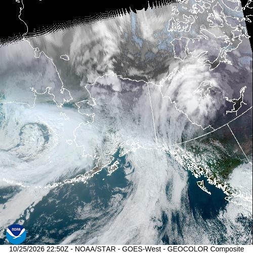
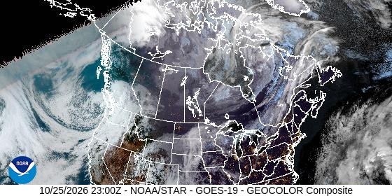
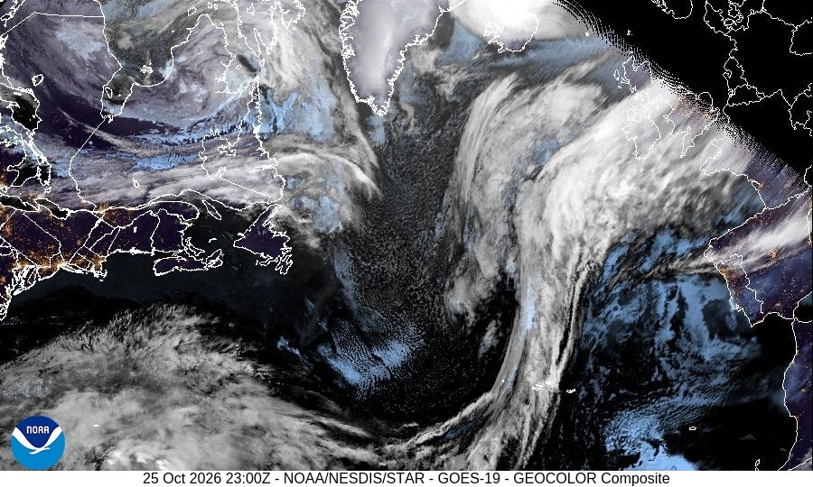
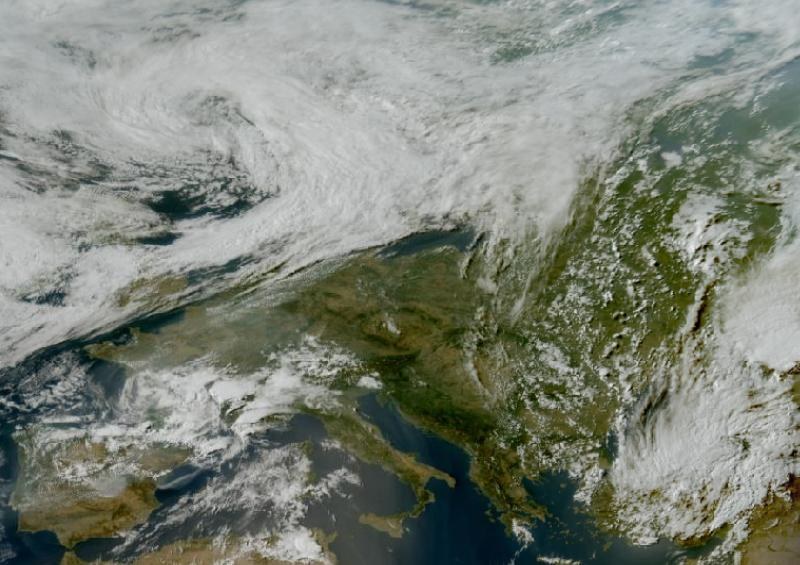

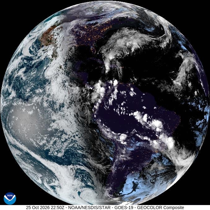
Satellite View

Sunspots
Current sunspot number: 22

Coronal Mass Ejections
Aurora Photography by Todd Salat
Original prints from Todd Salat's collection.

AK Caboose
Portage Depot, Alaska · 2021

Alaska Gold
Talkeetna, Alaska · 2009

Anchorage Lights
Anchorage, Alaska
Nerd Mode
Solar Wind & IMF (GSM)
- Bt
- 4 nT
- Bx
- 0.2 nT
- By
- 4 nT
- Bz
- 0.3 nT
- Clock Angle θ
- 4.4°
- Cone Angle φ
- 86.9°
- Speed
- 348 km/s
- Density
- 3.8 p/cc
IMF Detail (GSE) & Source
- Bx
- 0.2 nT
- By
- 3.9 nT
- Bz
- 1.1 nT
- θ Angle
- 15.2°
- φ Angle
- 86.8°
- Satellite
- SOLAR-1
- Data Quality
- Good
- Reading Time
- Oct 25, 6:09 PM EDT
Geomagnetic Indices
- Kp (now)
- 0
- Dst
- 10 nT
- HPI
- 9 GW
- Sunspot Number
- 22
Aurora Model
- Ovation Value
- 0
- Ovation Label
- None
- Model Data Time
- Oct 25, 7:17 PM EDT
- Ovation Data
- Live
Scores & Ratings
- Aurora Visibility
- 0 · Poor
- Aurora Visibility (w/ Moon)
- 0 · Poor
- Prediction Score
- 0 · Little to None
Sky & Location
- Cloud Cover
- 1% · Clear
- Clouds, Next Dark Window
- 79% · Mostly Cloudy · ×0.50
- Aurora Visibility Tonight
- 0 · Poor (Outlook Tonight 0 × cloud 0.50)
- Solar Elevation
- 3.9° · Daytime
- Moon Phase
- Full Moon
- Moon Illumination
- 100%
- Moon Altitude
- 2.2° · Up
- Latitude
- 44.74556
- Longitude
- -85.55118
- Geomagnetic Latitude
- 53.8°
- Horizon Threshold
- Kp 5
- Overhead Threshold
- Kp 7
Prediction Model Inputs
- Bz Persistence (60min)
- 0.5 nT
- Newell Coupling
- 2207
- Latitude Gate
- 0.00 now · 0.00 tonight (horizon Kp 5.2, verdict rounds to Kp 5)
- Dynamic Pressure
- 0.8 nPa
- Storm Watch (CME)
- —
- Watch Predicted Kp
- —
Timing & Signal Agreement
- Timing
- Tonight
- Signal Agreement
- High (5 of 5)
- Do the live inputs point the same way as the score? A score lifted by this city's own Kp can read Low while the solar wind is calm.
- L1 Delay
- ~72 min
- Magnetic Midnight
- 1:37 AM (peak hours 11:37 PM – 3:37 AM)
- Best Viewing Window
- 7:12 PM – 7:42 AM EDT (12h 30m)
3-Day Kp Forecast
| UT slot (EDT) | Oct 25 UT | Oct 26 UT | Oct 27 UT |
|---|---|---|---|
| 00–03 UT (8:00 PM–11:00 PM) | 2 | 3 | 1.67 |
| 03–06 UT (11:00 PM–2:00 AM) | 3 | 2 | 1.33 |
| 06–09 UT (2:00 AM–5:00 AM) | 3 | 2 | 1.33 |
| 09–12 UT (5:00 AM–8:00 AM) | 3.33 | 2 | 1.33 |
| 12–15 UT (8:00 AM–11:00 AM) | 4 | 2 | 1.33 |
| 15–18 UT (11:00 AM–2:00 PM) | 3.33 | 2 | 1.33 |
| 18–21 UT (2:00 PM–5:00 PM) | 4 | 2 | 1.67 |
| 21–00 UT (5:00 PM–8:00 PM) | 3 | 2.33 | 1.67 |
| Max | 4 | 3 | 1.67 |
| Ap Index | 18 | 8 | 5 |
Columns are NOAA's UT days, so in EDT a column's first rows fall on the previous local evening.
Storm Probability
| Level | Oct 25 UT | Oct 26 UT | Oct 27 UT |
|---|---|---|---|
| Active | 35% | 30% | 10% |
| Minor storm | 25% | 5% | 1% |
| Moderate storm | 10% | 1% | 1% |
| Strong-Extreme storm | 1% | 1% | 1% |
Planetary K-index
Interplanetary Magnetic Field Bz0.3 nT now
Southward (negative) Bz favors aurora. Observed data only, no forecast product exists for Bz.
Total IMF Field Bt4 nT now
Total interplanetary magnetic field strength - the ceiling on how negative Bz can go. A rising Bt alongside a still-fluctuating Bz often leads a stronger southward turn. Observed data only, no forecast product exists for Bt.
Global Storm Trend11 global now
Global (hemisphere-wide, not this city) prediction score over the last 24 hours, logged every 5 minutes - may differ from the Prediction ring above, which is specific to this location and time of night. Red from 60 (Strong), yellow from 40 (Moderate), teal below - the same cutoffs as the Prediction ring. Dashed line is the overall trend.
Dst History10 nT now
Kyoto Dst geomagnetic storm index over the last 24 hours. Negative = ring-current energy stored = an active storm, not just predicted. Red below −50nT, yellow −20 to −50nT, teal above −20nT.
Solar Wind Speed & Pressure
Each line is scaled independently to its own 24h range (different units) - watch the shape, not a shared axis. A rising speed line or a pressure spike can signal an incoming stream or shock before Bz/Dst move.
Nerd Mode: See what’s really driving the score. Live solar wind, Bz, Kp, Dst, CME timing, and more. Data comes from NOAA SWPC and the Kyoto WDC, with a few metrics calculated here from the raw data. Live data refreshes every minute; trend charts every five.
Debug / Test Data
UTC: 2026-10-25 22:12:52
| Variable | Value |
|---|---|
| Geo | |
| locale (GET) | traverse-city-state-park-michigan |
| pred_city | Traverse City State Park |
| pred_region | Michigan |
| pred_lat | 44.74556 44.74556° N |
| pred_lon | -85.55118 85.55118° W |
| pred_tz | America/Detroit |
| Cloud Cover (Open-Meteo) | |
| cloud_pct | 1% |
| cloud_cover | clear |
| cloud_mult | 1.00 (100%) |
| Sky Darkness | |
| dark_elev | 3.89° |
| dark_label | Daytime |
| dark_mult | 0.00 (0%) |
| Space Weather | |
| cKp (current) | 0 |
| bz (nT) | 0.3 |
| speed (km/s) | 348 |
| day1_max Kp | 4 |
| day2_max Kp | 3 |
| day3_max Kp | 1.67 |
| Aurora Score 0–4 None · 5–19 Weak · 20–49 Nearby · 50–100 Overhead | |
| ovation_val | 0 (None) |
| ovation_time | 2026-10-25T23:17:00Z |
| space_score | 0 |
| Space Weather | |
| bz_score | 0% |
| bz_bar | 48.5% (visual) |
| kp_score | 0% |
| fcst_score | 57.1% |
| Visibility Score 0.15×Ovation + 0.55×Bz + 0.30×Kp | |
| activity_score | 0 |
| Aurora Visibility Visibility Score × cloud × darkness | |
| × cloud_mult | 1.00 (Clear) |
| × dark_mult | 0.00 (Daytime) |
| aurora_score | 0 (Poor) |
| Aurora Visibility Tonight Outlook Tonight × cloud (dark window) × 1.0 | |
| pred_score_tonight | 0 (Little to None) |
| × cloud_mult_tonight | 0.50 (Mostly Cloudy 79%) |
| aurora_score_tonight | 0 (Poor) |
| Cache Freshness * = per-request, no cron | |
| Kp Index _kps/ | fresh 52s / 60s |
| Bz / RTSW outlook/ | fresh 13s / 60s |
| Solar Wind outlook/ | fresh 8s / 60s |
| Sunspots _kps/ | fresh 19.5h / 24h |
| Ovation Aurora outlook/ | fresh 5m / 5m |
| 3-Day Geomag * outlook/ | fresh 12m / 1h |
| GeoIP DB geoip/ | fresh 14.6h / 168h |
| geo (newest) * outlook/geo/ | fresh 3m / 24h |
| wx (newest) * outlook/wx/ | fresh 1s / 20m |
| Image Cache /_files/_dynamic/_images/ · cron every 15m | |
| Ovation North | fresh 6m / 15m |
| Ovation South | fresh 6m / 15m |
| Sat - Alaska | fresh 6m / 15m |
| Sat - N. America | fresh 6m / 15m |
| Sat - N. Atlantic | fresh 6m / 15m |
| Sat - Europe | fresh 6m / 15m |
| Sat - Australia | stale 4.2h / 15m |
| Sat - S. America | fresh 6m / 15m |
Legend
| Visibility Rating (aurora_score /100) | ||
|---|---|---|
| Poor | 0–29 | Little chance of seeing aurora |
| Fair | 30–49 | Possible under ideal conditions |
| Good | 50–69 | Good chance if skies clear |
| Excellent | 70–100 | Strong aurora likely visible |
| Ovation Label (0–100 scale) | ||
|---|---|---|
| None | 0–4 | No aurora activity at location |
| Weak | 5–19 | Faint aurora, auroral oval nearby |
| Nearby | 20–49 | Aurora active, oval edge overhead |
| Overhead | 50–100 | Aurora directly overhead |
| Cloud Cover Multiplier (cloud_pct %) | ||
|---|---|---|
| Clear | 0–25% | × 1.00 |
| Partly Cloudy | 26–50% | × 0.85 |
| Mostly Cloudy | 51–85% | × 0.50 |
| Overcast | 86–100% | × 0.05 |
| Unknown | — | × 0.60 |
| Label | Elev. | Mult | Setting | Rising |
|---|---|---|---|---|
| Daytime | ≥ 3° | × 0.00 | Sun above horizon. Check back after sunset. | Sun well above horizon. Aurora viewing is over. |
| Appr. Civil | 0–3° | × 0.00 | Sunset imminent. Watch for aurora soon. | Approaching sunrise. Aurora window closing. |
| Civil Twilight | −4–0° | × 0.10 | Too bright yet. Darkness improving. | Brightening. Last chance to catch aurora. |
| Appr. Nautical | −6–−4° | × 0.10 | Sky darkening. Faint aurora may be visible. | Sky brightening. Window narrowing. |
| Nautical Twilight | −12–−6° | × 0.50 | Sky darkening. Bright aurora may be visible. | |
| Astronomical Twilight | −18–−12° | × 0.85 | Near-dark sky. Good aurora viewing conditions. | |
| Dark Night | < −18° | × 1.00 | Full darkness. Optimal aurora viewing. | |
Related Northern Lights Pages


Browse all prediction cities →


